
Barnstable County ZIP Code Coverage
ZIP codes in Barnstable County are delivery geography, not municipal boundaries. The Registry villages of Cape Cod table is the clearest county-specific crosswalk found. It pairs village, legal town, and ZIP combinations. The table below lists the ZIPs shown for Barnstable town, which is only one of the county’s 15 towns. Its village labels are useful for normalizing an address, but a lookup that involves a deed, parcel, voter list, or town record must stay tied to the legal town.
| ZIP code | Areas covered in the Registry table | Postal label | Record-search note |
|---|---|---|---|
| 02630 | Barnstable village | Barnstable | Use the Town of Barnstable records for municipal research. |
| 02632 | Centerville | Centerville | Village label within Barnstable town. |
| 02635 | Cotuit and Santuit | Cotuit/Santuit | One ZIP can cover more than one village. |
| 02636 | Craigville | Craigville | Also used by East Falmouth in Falmouth. |
| 02637 | Cummaquid | Cummaquid | Confirm the town before opening a local record. |
| 02601 | Hyannis | Hyannis | Village and postal label are not a separate county jurisdiction. |
| 02647 | Hyannis Port | Hyannis Port | Use the legal town field from the parcel source. |
| 02648 | Marstons Mills | Marstons Mills | Village label within Barnstable town. |
| 02655 | Osterville | Osterville | Village label within Barnstable town. |
| 02668 | West Barnstable | West Barnstable | Local-history sources may use this village heading. |
| 02672 | West Hyannis Port | West Hyannis Port | Preserve the ZIP and town separately in notes. |
| 02674 | Wianno | Wianno | Postal wording does not replace parcel jurisdiction. |
For the remaining county towns, consult the same official table instead of relying on a remembered code. It also lists ZIPs for Bourne, Brewster, Chatham, Dennis, Eastham, Falmouth, Harwich, Mashpee, Orleans, Provincetown, Sandwich, Truro, Wellfleet, and Yarmouth.
Barnstable County Villages by ZIP Code
The village crosswalk is valuable because local source headings change. A directory may say Hyannis, a parcel may identify Barnstable town, and a delivery address may use a village label. Retain all three pieces when they appear. The Registry’s county table is a normalization tool, not a boundary survey. It helps prevent a search from being sent to the wrong town office simply because the postal wording is familiar. It is especially useful for a historical directory, map, or deed that uses a village rather than a modern municipal label.
The official villages and ZIP crosswalk is shown below with its Barnstable County entries.
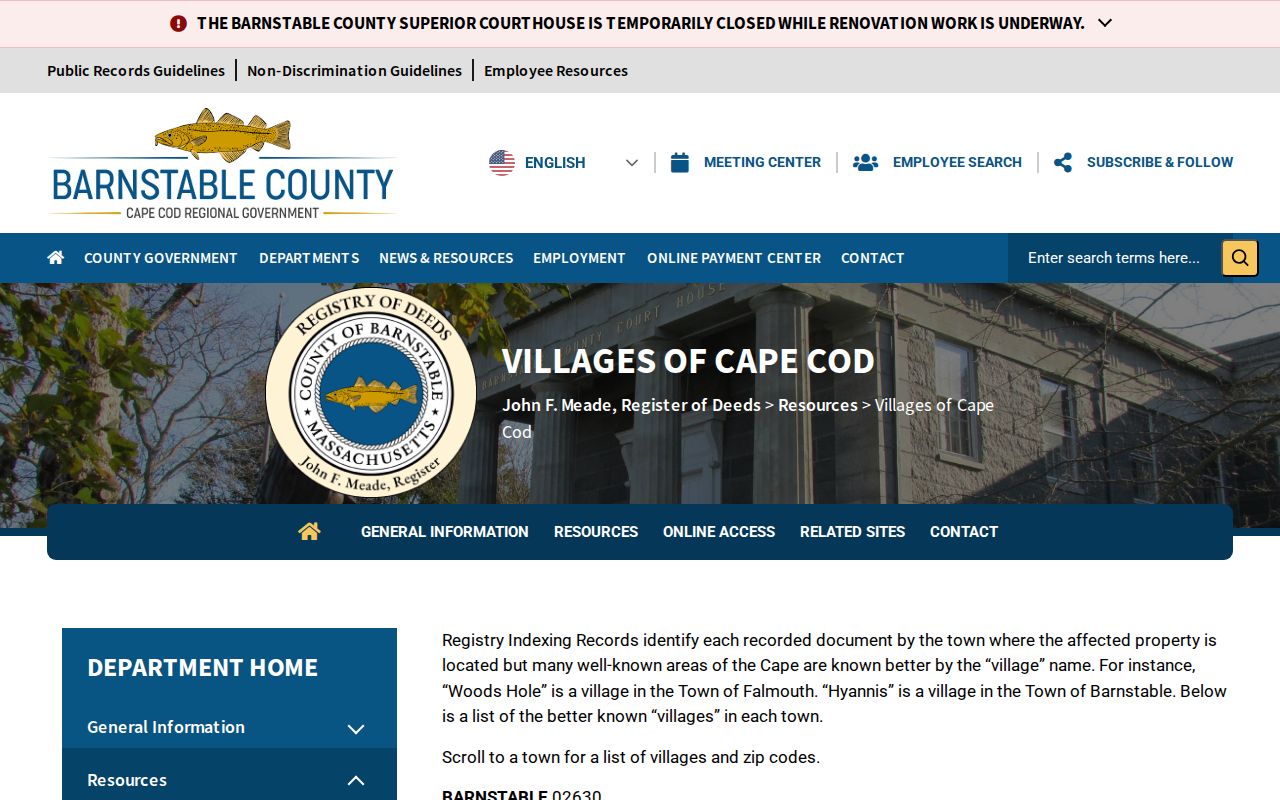
Use the village label to find an edition or map section, then use the legal town to find assessor, clerk, tax, and election records. Note: a countywide publication can use Cape, town, or village headings, so save the source’s exact wording.
Search a Barnstable County ZIP Code
A ZIP can narrow a search, but it should not be used to build a list of people. The official USPS ZIP Lookup offers By Address, By City/State, and Cities by ZIP modes. Use the returned ZIP and delivery-city formatting as postal evidence. USPS says it cannot guarantee that a displayed address is an actual business location, and the tool does not decide legal town boundaries. Once the address is normalized, the parcel and Registry route is more precise for local record research.
- Run the address or city/state through USPS and record the returned delivery city and five-digit ZIP.
- Check the Registry villages table to compare the village label with the legal town.
- Search the relevant town assessor or GIS system by street, address, parcel, or map/block/lot, since the inspected Barnstable assessor form has no ZIP field.
- Use the parcel owner or legal description for a Barnstable County Registry search when a recorded document is needed.
- Keep the lookup date with the ZIP because postal assignments can change while municipal boundaries do not.
When a ZIP has narrowed the place to one street, the address-record chain belongs in the Barnstable County street directory workflow.
Barnstable County ZIP Search Controls
Only some official forms actually accept a ZIP. USPS has the clearest delivery-focused controls. Massachusetts’ individual voter-registration status form requires first name, last name, birth date, a five-digit ZIP, and an agreement checkbox, but it is intended for an individual checking their own status rather than a public countywide person search. The state occupational-license search includes city, state, and ZIP fields, although a returned license address may be business or mailing information. The Town of Barnstable assessor form has no ZIP field in the inspected interface.
| Official source | ZIP-capable control | What it helps confirm | Key limit |
|---|---|---|---|
| USPS ZIP Lookup | By Address, By City/State, Cities by ZIP | Delivery ZIP and postal city formatting | Does not set legal town boundaries |
| Massachusetts voter status lookup | Five-digit ZIP with name and date of birth | An individual’s own registration status route | Not a public countywide resident search |
| Massachusetts license search | City, state, and ZIP | License-search narrowing | Address may be business or mailing information |
| Town of Barnstable assessor | No ZIP field observed | Address, owner, or map/block/lot parcel research | Town-specific, not countywide |
For a local voter list, the appropriate town election office controls the public request. Public fields and statutory redactions depend on the list and request, while statewide-list access is restricted.
For a county-held record, a narrowly described request under the Barnstable County public-record guidelines should identify the custodial office, record class, date range, and preferred delivery. The county ordinarily responds within ten business days with production, withholding, fee, or extension information. A ZIP alone is not a sufficient description of the record or town needed for a meaningful request.
Map Barnstable County ZIP Code Geography
MassGIS ZIP Code data explains an important limitation: USPS does not publish an official ZIP polygon map. The MassGIS boundaries are approximate, derived from delivery points and a 2018 HERE source supplemented with more recent USPS files. Their fields include postal name and city or town. That makes the layer useful for geographic context and aggregation, not for deciding whether a house is legally inside a town or for identifying a delivery route at parcel precision.
The MassGIS documentation shown below describes the approximate ZIP geography used in a Barnstable County ZIP code directory.
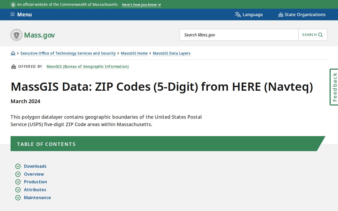
Census ZIP Code Tabulation Areas are similarly generalized and are not USPS delivery routes. Use either map layer for broad context, then return to an address, parcel, and legal town for a records question. The MassGIS parcel dataset standardizes assessor parcels across Massachusetts communities, but its statewide view may lag a local assessor’s live data. For a current Barnstable County parcel question, the relevant town source remains the better first stop.
Barnstable County ZIP Codes and Town Limits
A ZIP boundary and a city-limit concept do not line up cleanly in this county because many source labels are villages and the county is organized around towns. The Town of Barnstable is not the same thing as Barnstable County, and a postal label may be shared with another town. For example, a 02636 delivery clue needs the street address and legal town before an assessor, Registry, court, or town-clerk search can be trusted. The safest record note keeps the delivery ZIP, village or postal label, legal town, parcel identifier where available, and source date together.
- ZIP code
- A postal delivery code, useful for routing and normalization but not a municipal boundary.
- ZIP+4
- An added delivery segment used with a five-digit ZIP; it does not replace the legal town field.
- Postal label
- The city or village wording returned for delivery purposes, which may differ from the municipal record custodian.
- Approximate ZIP polygon
- A map representation built from delivery geography, appropriate for context rather than a parcel-level decision.
Keep both labels. For Barnstable County research, record the village or postal wording and the legal town instead of choosing one over the other.
Barnstable County ZIP Code Limits
A ZIP is not proof that a person lives at an address, owns a parcel, or belongs to a municipality. A parcel record may show an owner and fiscal-year context; a Registry instrument may show recorded parties and a recording date; a historical directory may show a dated listing. Each describes a separate relationship. Public voter information also has protected categories, including confidential voters and minors. The Massachusetts Address Confidentiality Program protects substitute addresses that must not be reverse-engineered through public sources.
Use only the narrow record and date needed for lawful personal research. Do not use ZIP or address information to stalk, harass, intimidate, or harm anyone.