
Barnstable County Previous Resident Sources
Barnstable County previous residents research begins by sorting sources by their date and purpose. The Registry provides a countywide instrument trail, while town assessors anchor the modern parcel. Library, archive, and map materials add the household layer that deeds alone cannot supply. A record may name an owner, a grantor, a listed household, or a building use, and those are not interchangeable relationships.
| Source | Years It Covers | Where Held | What It Shows |
|---|---|---|---|
| Recorded Land index and images | 1704 to present | Barnstable County Registry of Deeds | Recorded parties, instruments, and property trail |
| Land Court images | 1899 to present | Registry Land Court route | Registered-land documents; name index incomplete |
| Registry address aid | August 1993 forward | Registry address search | Unofficial address lead across land tracks |
| State Library directories | 1895, 1901, and 1926 holdings | Massachusetts State Library | Dated resident, business, or street listings |
| Sturgis census records | 1850, 1860, 1870, and 1880 | Sturgis Library finding aid | Incomplete handwritten county-town material |
| Whelden local indexes | Before 1950 through 2006 | Whelden Memorial Library | West Barnstable people, homes, and events leads |
For recent past residents, begin with the legal town's parcel record and the Registry. For an early or historical address, begin with the parcel or plan if known, then test directories, census material, probate, maps, and library indexes against the same town and period.
Search Barnstable County Previous Resident Deeds
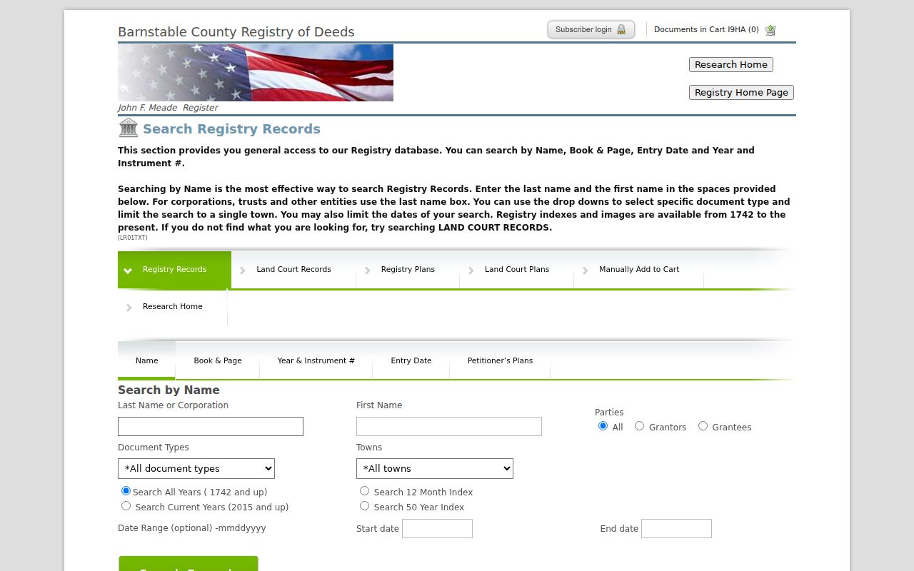
The Barnstable County Registry public access covers all 15 towns and provides Recorded Land, Land Court, plans, and address-search routes. Indexes and on-screen images are free to view. The name form supports last name or corporation, first name, grantor or grantee role, document type, town, date or index windows, wildcards, and exact-name searching. It is stronger than an address-only pass because a street address can change or be absent from an older record.
The Barnstable County Registry address aid is still useful as a first pass. It accepts a partial property address, document-type and town filters, and a date range, but its notice says the address index begins in August 1993, is unofficial, and may be incomplete or unverified. Omit a suffix or try the street root if needed. Then move to the assessor's displayed owner and run name searches in both Recorded Land and Land Court.
The official Registry name-search form makes the party role and town controls visible before a prior-owner trail is assembled.
Capture the instrument number, book and page, recording date, town, document type, party role, and image status so the next link in the chain can be checked later.
Normalize a Barnstable County Previous Address
Before tracing Barnstable County past residents, record the house number, street root and suffix, unit or lot, village or post office, legal town, ZIP, parcel identifier, and date of each source. A street spelling, village heading, or postal label can differ without pointing to a new parcel. The durable join is often the map/block/lot or parcel ID, not the modern street format.
The official villages table is useful for checking labels such as Hyannis, West Barnstable, or Osterville against Barnstable town. It also shows that ZIP 02636 serves Craigville in Barnstable and East Falmouth in Falmouth. Retain the town returned by the parcel source even when an older directory uses a post-office name. When a map, deed, or street guide differs, keep both forms and compare the plan, bounds, and neighboring features.
For building history, the town's permit information says older applications, inspections, and permits moved into its current online system. Use a targeted parcel search first; an account may be required, and a completed label is not necessarily final sign-off. For a larger historical batch, ask the town for property cards, permits, inspections, and publicly releasable parcel records for the exact address and date range, with exempt information excluded and electronic delivery preferred.
Trace a Barnstable County Previous Resident Deed Chain
A Barnstable County deed chain is a backward sequence of recorded interests, not a list of occupants. Start with a parcel or map/block/lot from the appropriate town assessor, then use the current displayed owner to locate a purchase or transfer in the Registry. A probate case, trust, estate, court order, or plan can explain a change where a straightforward deed does not appear.
- Save the exact parcel, legal town, fiscal year, map or lot reference, and displayed owner from the assessor or GIS record.
- Search that owner as grantee in Recorded Land and Land Court, then inspect the likely acquisition instrument.
- Use the seller or earlier grantee named in the document to repeat the search one transaction back.
- Keep document number, book/page, recording or entry date, town, party names, and the plan or legal description cited by the instrument.
- When the trail changes track, search Land Court, Town Books, probate, and related plans instead of assuming a missing owner.
- Grantor and grantee
- The party transferring an interest and the party receiving it in a recorded instrument.
- Chain of title
- A sequence of recorded transfers or related documents for an interest in property.
- Legal description
- The lot, plan, bounds, or other formal property description that can persist when a street label changes.
- Recorded Land and Land Court
- Different Registry tracks that may require separate searching for the same parcel history.
Check Barnstable County Previous Resident Probate
Estates, trusts, court orders, tax takings, and Land Court filings can explain why a familiar grantor-to-grantee sequence stops. The Registry warns that Land Court certificates before number 130989 are scanned originals that are not updated, and its Land Court name index is incomplete. Search the recorded and registered tracks, then carry a document number or book/page to the pertinent Probate and Family Court, clerk, or archive route.
The official historic probate guidance identifies Barnstable County probate indexes from 1686 to 1950 and record books from 1686 to 1873. A modern MassCourts absence does not test that older material. For unavailable historic files, use the Court Archives Information Request Form or contact the appropriate court custodian. The filing category points to the next source to inspect; it does not establish an outcome on its own.
Barnstable County Previous Resident Town Books
One Barnstable County records story changes any long property search. The 1827 Barnstable County courthouse fire destroyed all but one of 94 deed volumes. An 1828 statute allowed temporary town registries and re-recording of deeds up to 40 years old during a limited period. The resulting Town Books are scanned and indexed online or can be consulted in person. A property trail that suddenly shifts to a Town Book or Land Court document may reflect this survival and re-recording history, not a break in ownership.
Recorded Land date statements also describe different collection milestones: the Registry identifies complete Recorded Land index and images from 1704 forward, material beginning in 1742 in another description, and Land Court files from 1898 or 1899. Use the label shown by the item and avoid treating any one date as coverage for every original page.
Note: A later re-recording date can document an older instrument, so preserve both dates when the record displays them.
Use Barnstable County Previous Resident House Indexes
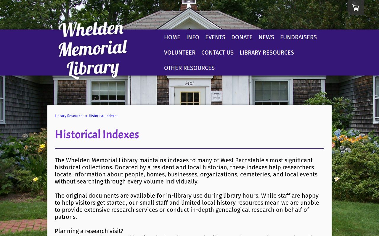
Libraries provide the people-and-place clues that a Barnstable County property transfer omits. Whelden Memorial Library's historical indexes cover West Barnstable people, homes, businesses, organizations, cemeteries, and events. The library describes historical volumes before 1950, 1950 to 1980, 1980 to 2000, and 2000 to 2006, though availability of the last volume should be confirmed. Staff can start a search but do not perform extensive research, so treat an index hit as a lead to the original material.
The Whelden indexes shown below identify the local categories available for a past-residents or house-history search.
Sturgis Library's countywide genealogy collections, probate finding aids, and local histories can supply a second route, particularly when a deed passes through an estate or early family record.
Pair Past Barnstable County Households
Barnstable County previous residents and prior owners are often different people. Historical city directories, house or street guides, voter lists, census schedules, newspapers, cemetery records, and probate material can show who was connected to an address at a particular time. The collections and their edition details belong with the Barnstable County city directory route; use each listing as a dated observation rather than as an unbroken occupancy claim.
- Choose a directory or local index closest to the deed or map date under review.
- Record the source's town or village heading, address wording, page, and the exact name as printed.
- Compare it with the nearest available census or town record, allowing for incomplete coverage and spelling variants.
- Use an obituary, cemetery entry, or probate docket only to test a time-linked connection, not to infer an address after the evidence ends.
The January 1906 Hyannis Sanborn map can add building footprints, street alignment, and nearby business context, but it is not a deed or occupancy roll. A historic directory's own locality heading matters because a county-branded Cape Cod directory may cover only selected towns.
The NARA directory guide identifies countywide Cape material for 1903, 1908, 1926, and 1929, while the State Library identifies Barnstable directory holdings for 1895, 1901, and 1926. A holdings guide establishes that a volume exists, not what a particular entry says. Record the repository, volume, town coverage, page, and access date before attaching a person or household to the address.